Posts

Showing posts with the label data quality

Crash Course: Elevation Imagery
Image
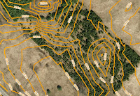
Sample contours map Find the right elevation imagery for your needs Elevation imagery from FBS is usually sold as either DEM with spot heights and break lines, or, as 1m interval contour lines derived from those DEM, but, we have a few other products you might not know about. As you can see in the chart, there are five products that you can extract elevation data from. Each has different types of deliverable's, precision, and geographic coverage:

How To Reference Digital Maps as Cited Works

Image
Beyond the book report If you need to reproduce a section of our maps and imagery to incorporate into your design proposal, research results, or similar professional documentation, spare a little room in your composition to cite your data sources correctly.  It not only fulfills the legal requirements of our EULA , the credibility and professionalism of your work goes up as well. Below you'll find some common examples for citing the source of data you've acquired from First Base Solutions as an inline citation in the border of a map or graphical compilation of data, figure details, footnote, or bibliography.

Let's Make A Deal

Image
How to sell your geospatial data through MapWarehouse We've got aerial imagery in spades. It makes a great base for many types of projects such as pre-engineering work, estimating material costs, or just to add context to your line drawings, but we know there's lots of quality data out there that would complement what you already find on MapWarehouse. That's where you come in. Related: The Essential Cheat Sheet For Purchasing Digital Geo Data

MapWarehouse - Search, Select, Review

Image
Ontario's largest geospatial data marketplace! We've reached the half way point of our series, MapWarehouse: SEARCH, SELECT, DOWNLOAD, WORK . Let's take a breather and talk about data. What to do with it and why it's worth it to spring for the stuff that's really top drawer, item selection drawer, that is. If you've been following the series, you'll understand what that means, if not, no worries, check out the recent posts here .

Be Inspired By INSPIRE

Image
Tips to manage a spatial data library. In private organizations, the CDO, or Chief Digital Officer, is a job that didn't exist just a few years ago and is still evolving.  They help companies adopt technology, manage digital resources, and get the biggest bang for buck out of the online economy, among other things. Spatial data management in particular is so important to the success of organizations these days, in the European Union, the INSPIRE directive was created to standardize the approach for the benefit of public policy makers across the entire European community, with full implementation expected by 2019.

Mr. Sid Who?

Image
Which image file format is best for my mapping project? At the MapWarehouse checkout, you'll need to choose a format for the files you've added to your cart before your order can be delivered. JPG and MrSID are the most popular compressed image formats. Both formats can be read by most up-to-date CAD and GIS software. The best file format to use for your particular project depends on what you're planning to do with the imagery layer. 

Why Doesn't The Property Boundary Line Up With The Aerial Image?

Image
Opinions, facts, and data quality. If you're a real estate agent , a lawyer , or perform any kind of on-location service s for property management, you'll understand my frustration with maps that just look wrong. A common combination is orthophoto and parcel data. If they're both correct, why does it look like this in some areas when you put them together? Related: Top Three Questions About Parcel Mapping [Cheat Sheet]